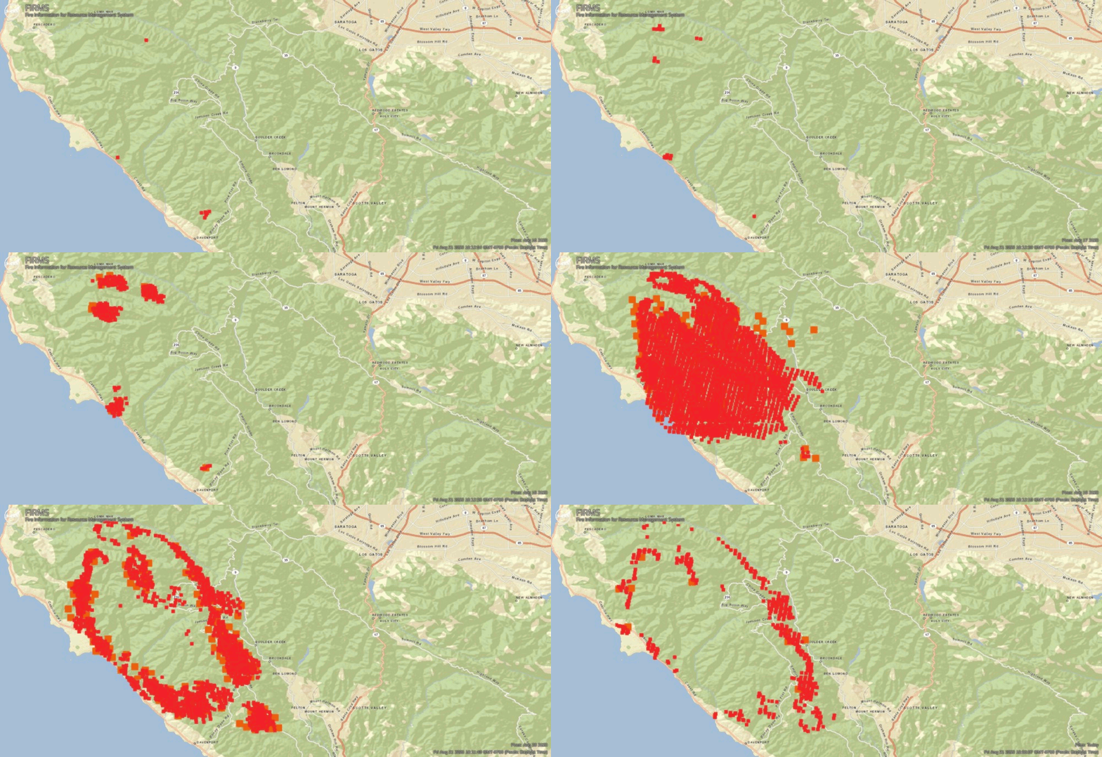
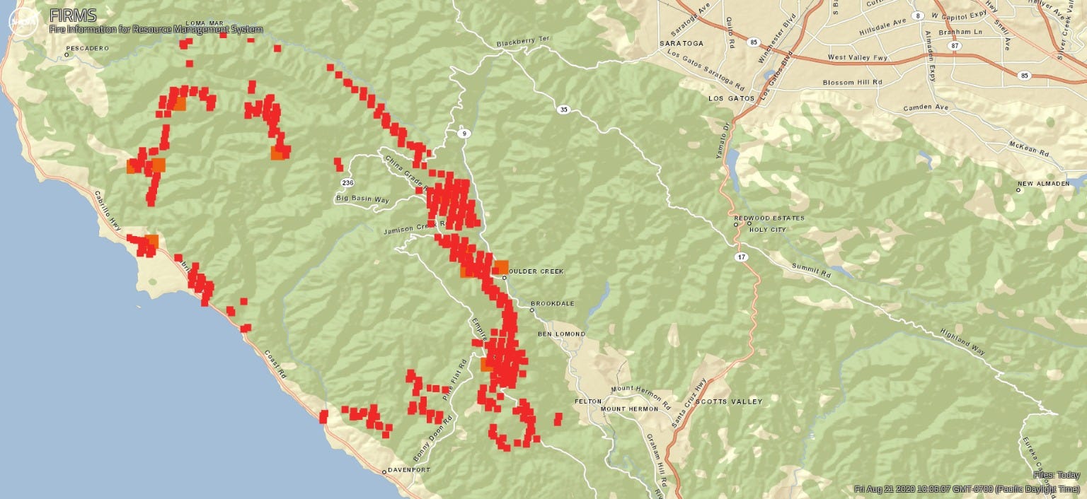
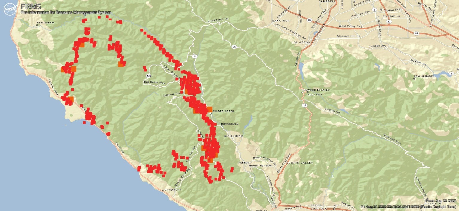
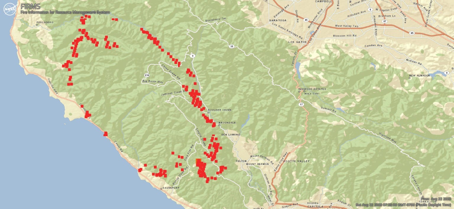
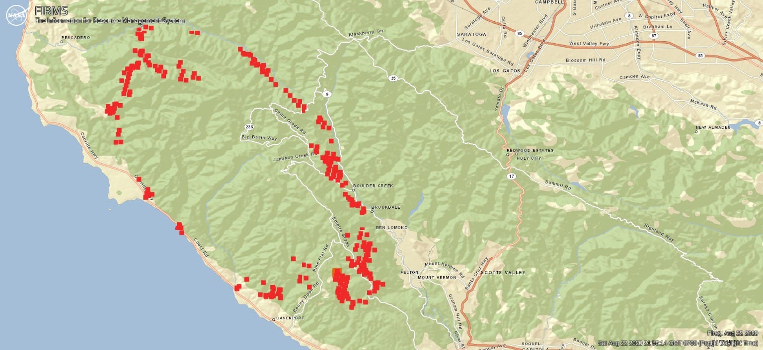
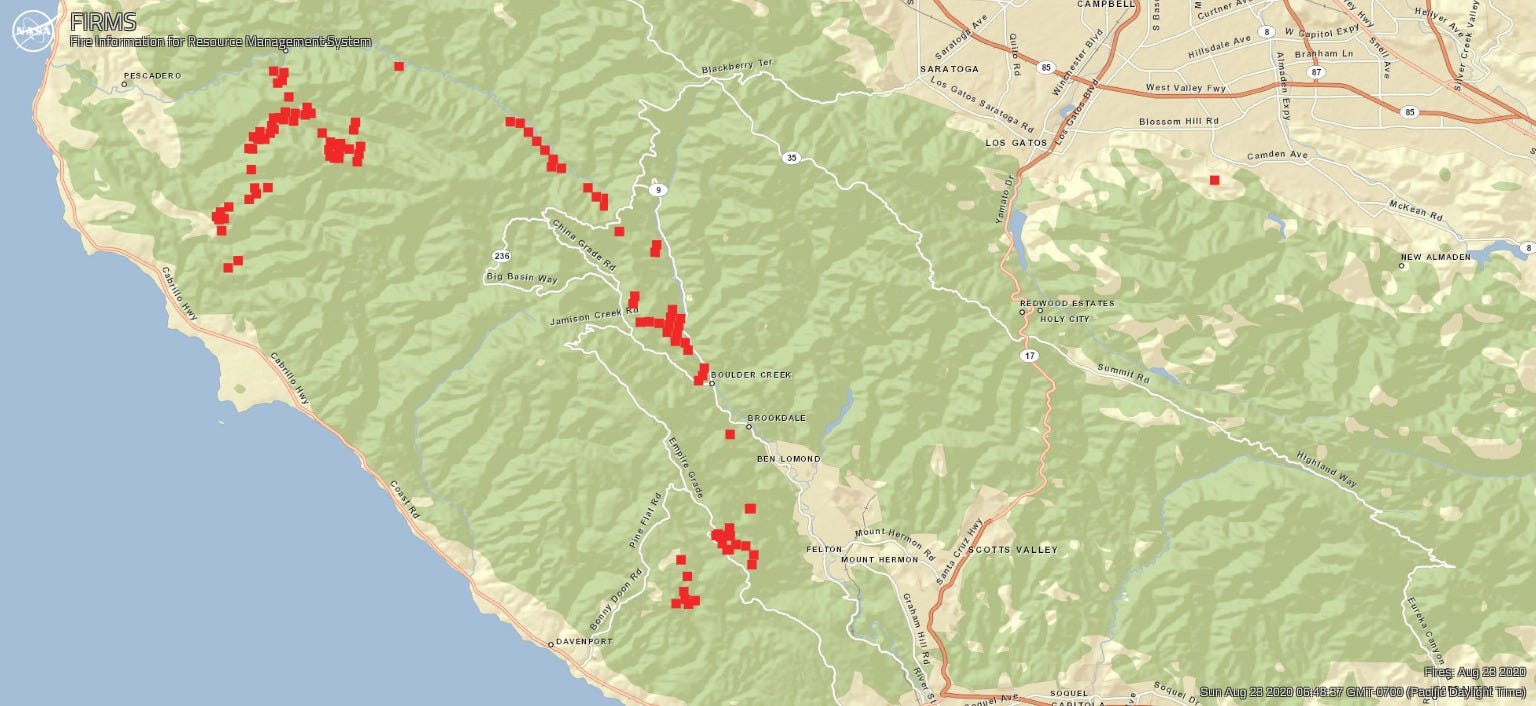
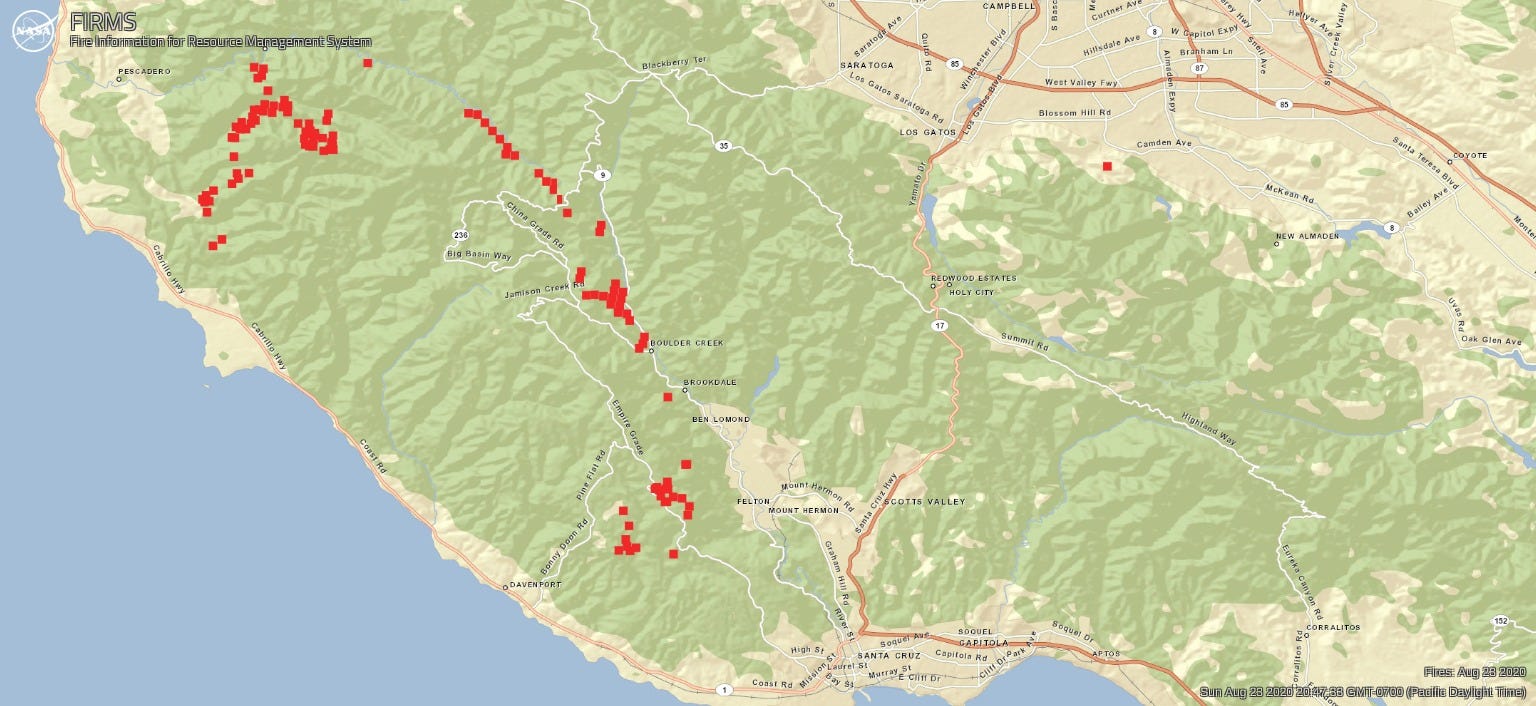
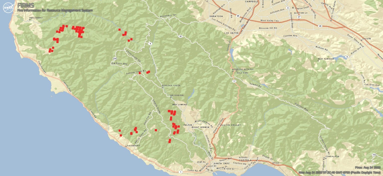
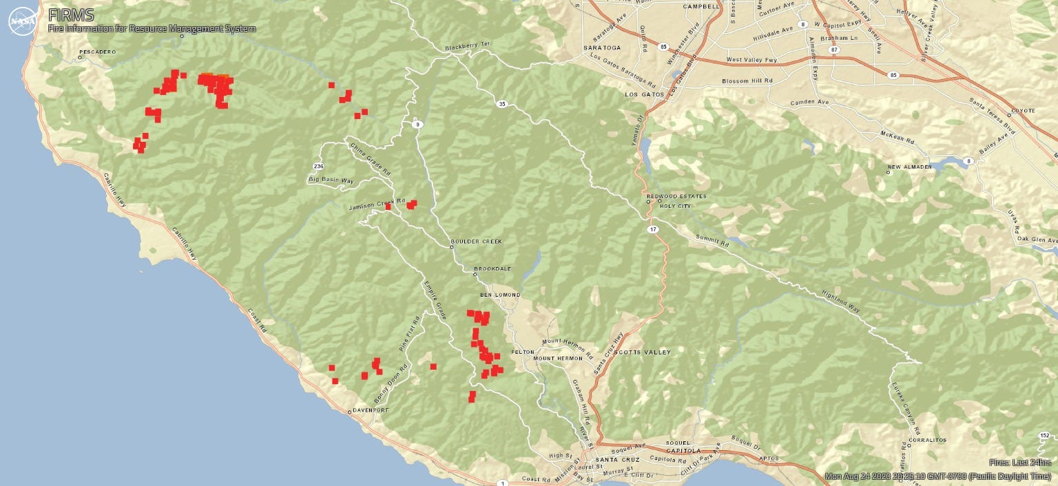
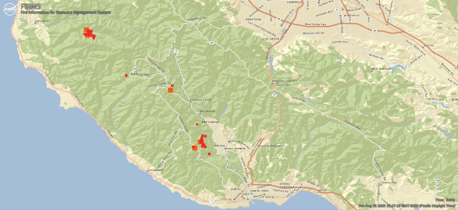
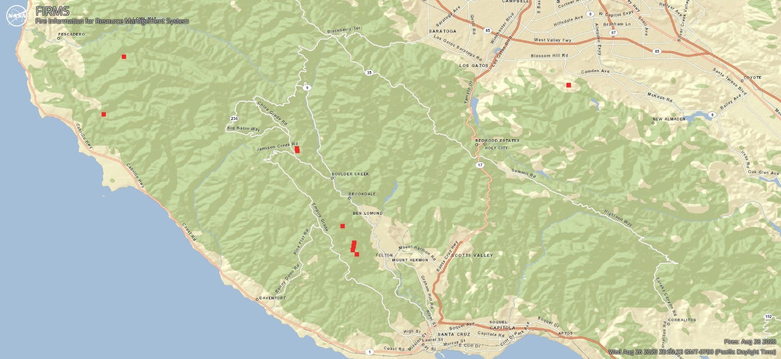
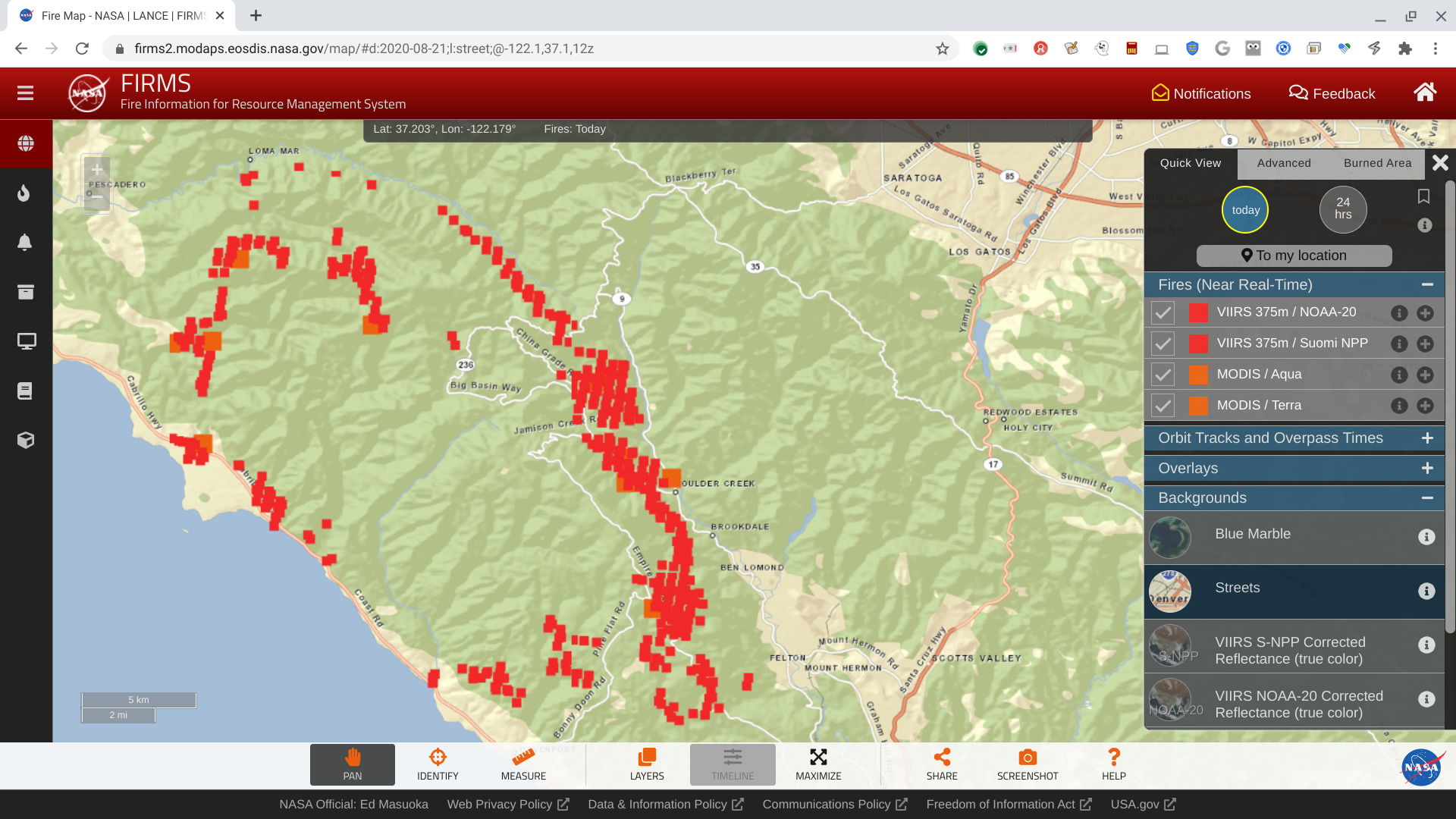
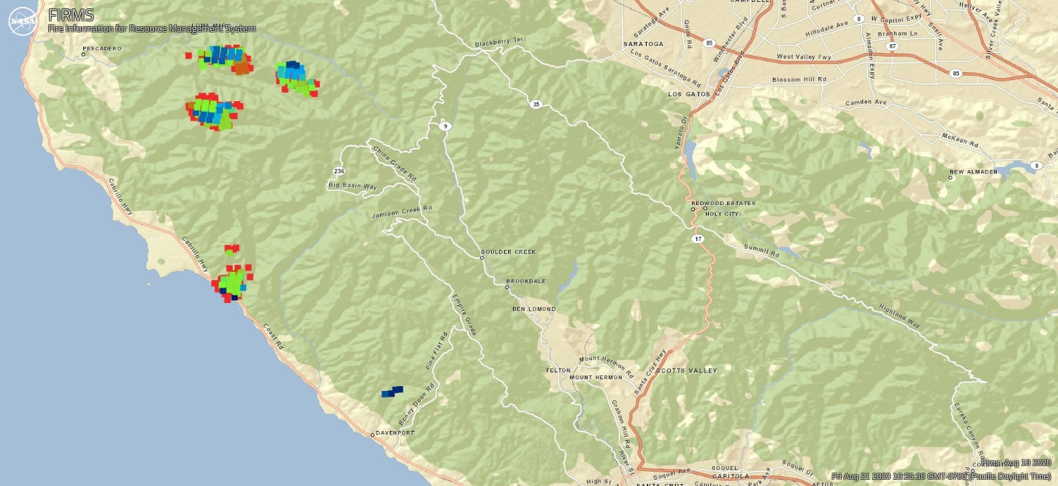
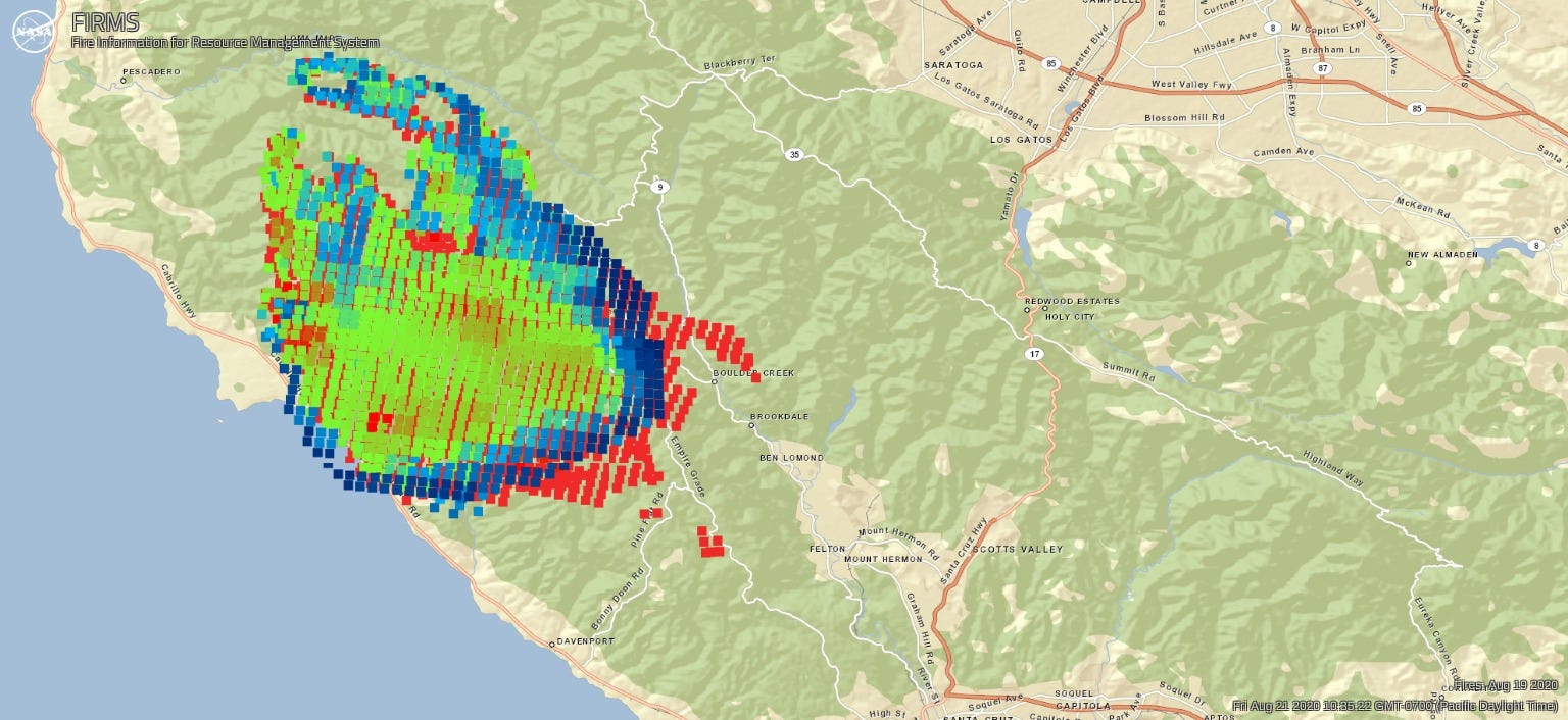
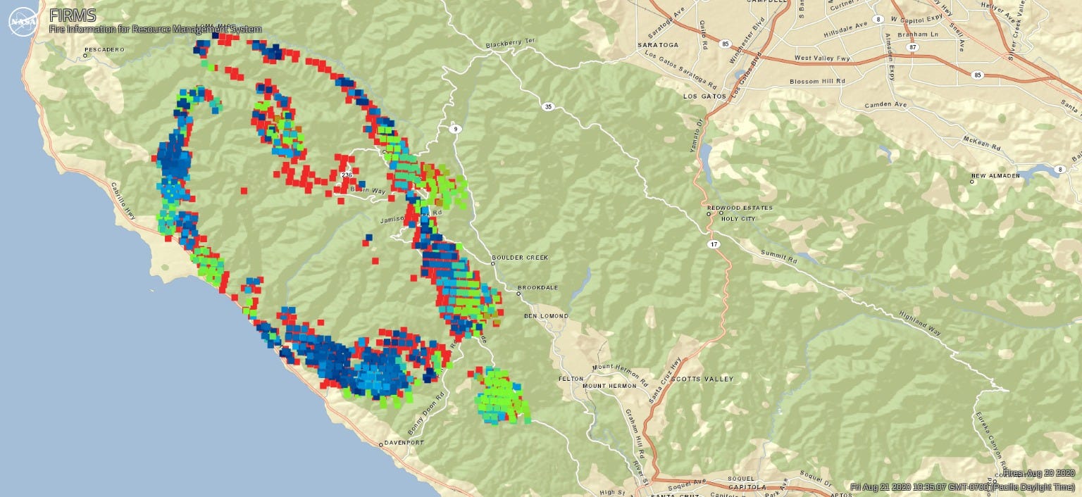
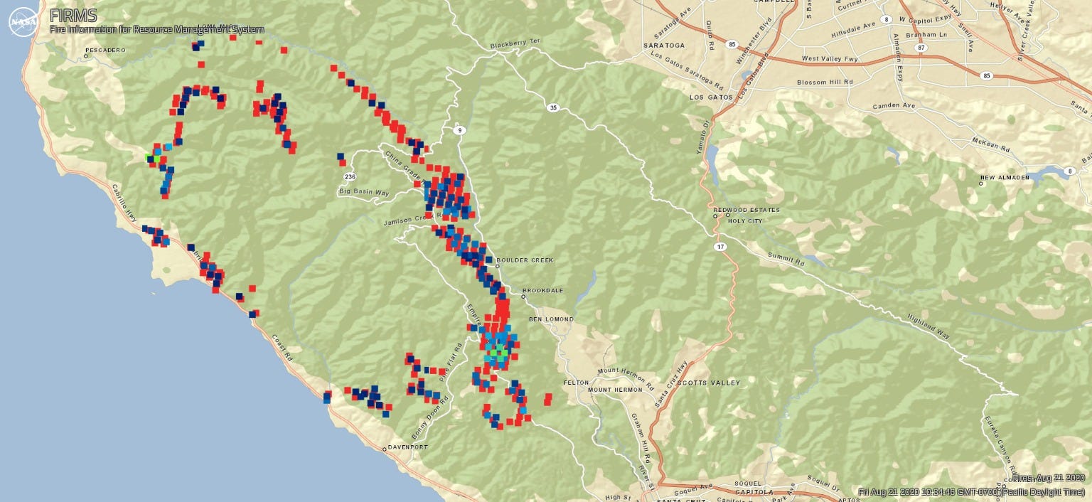
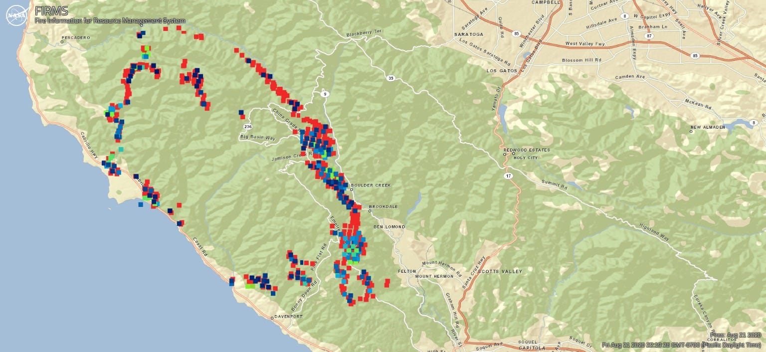
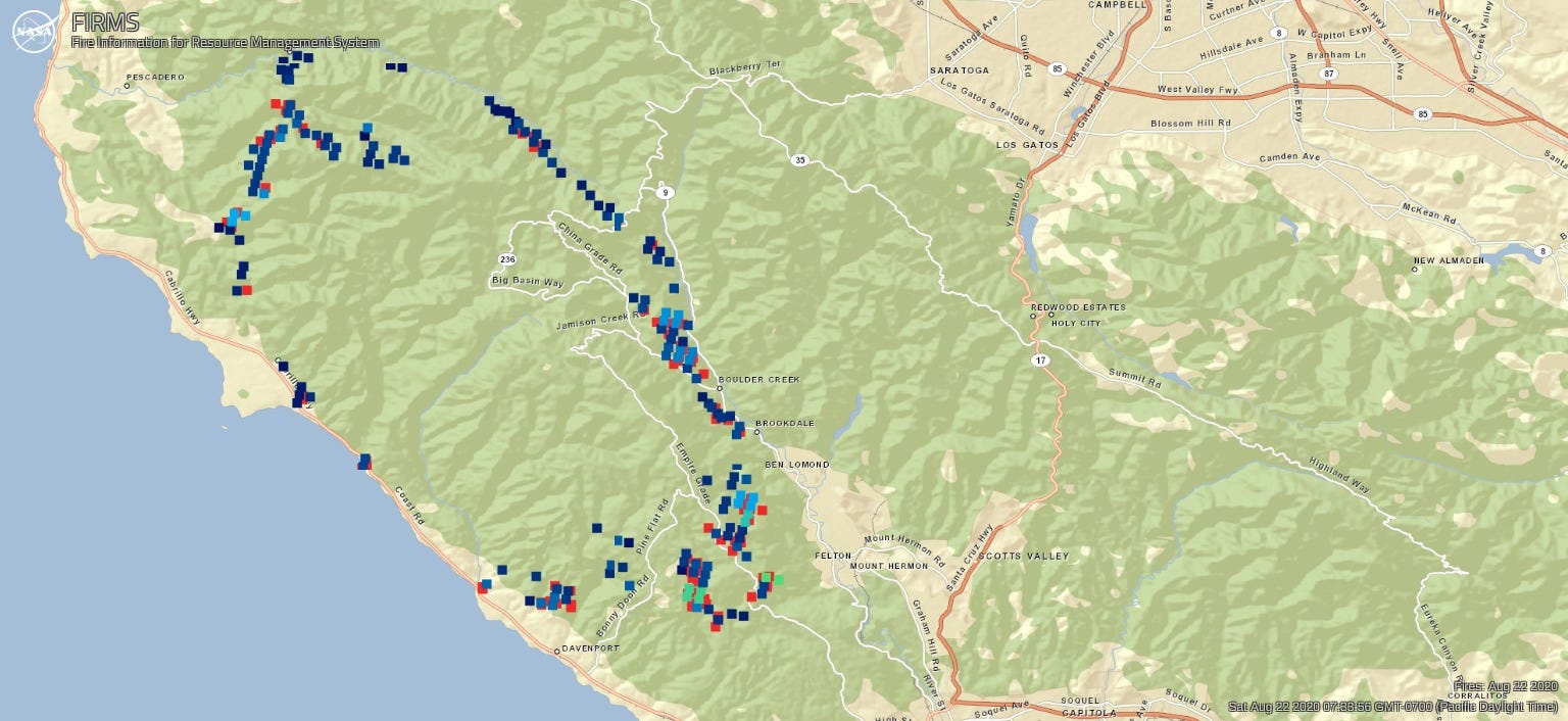
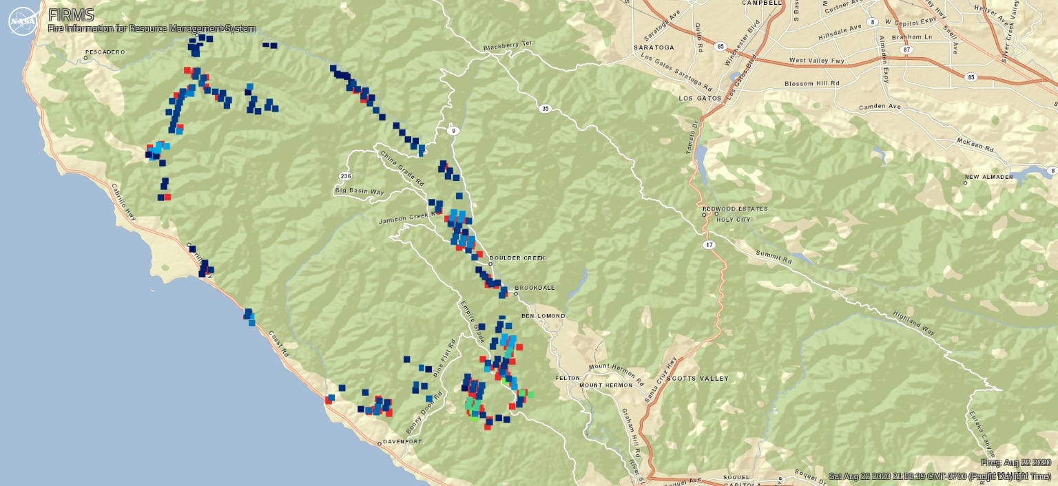
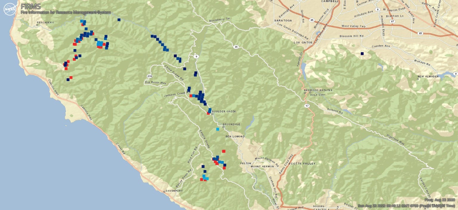
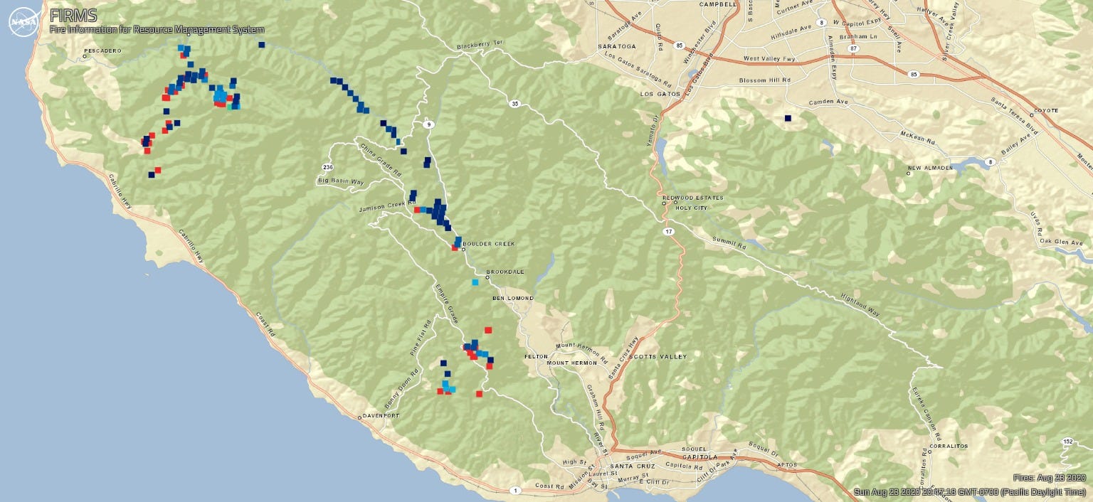
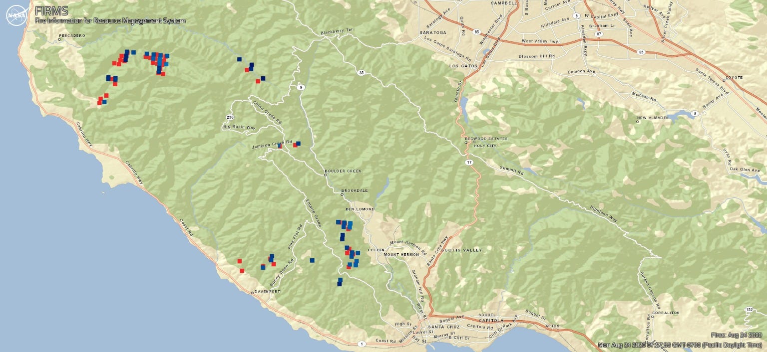
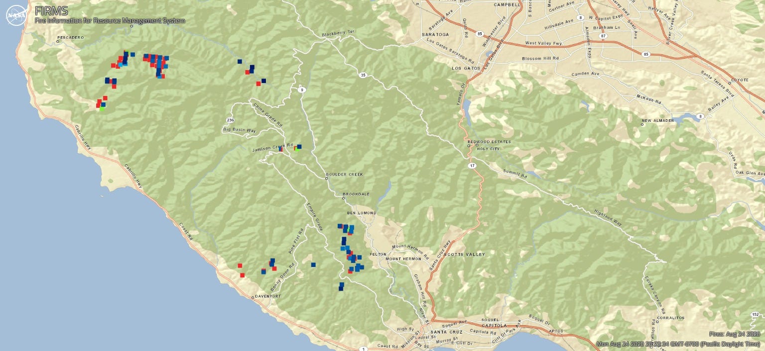
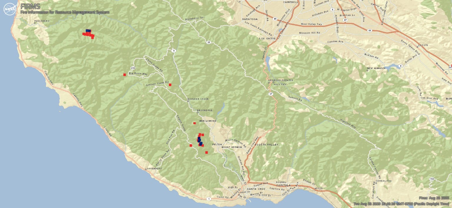
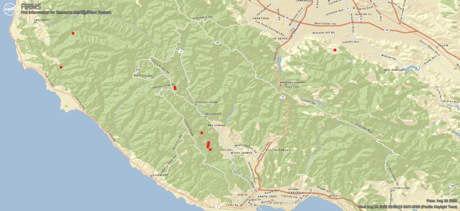
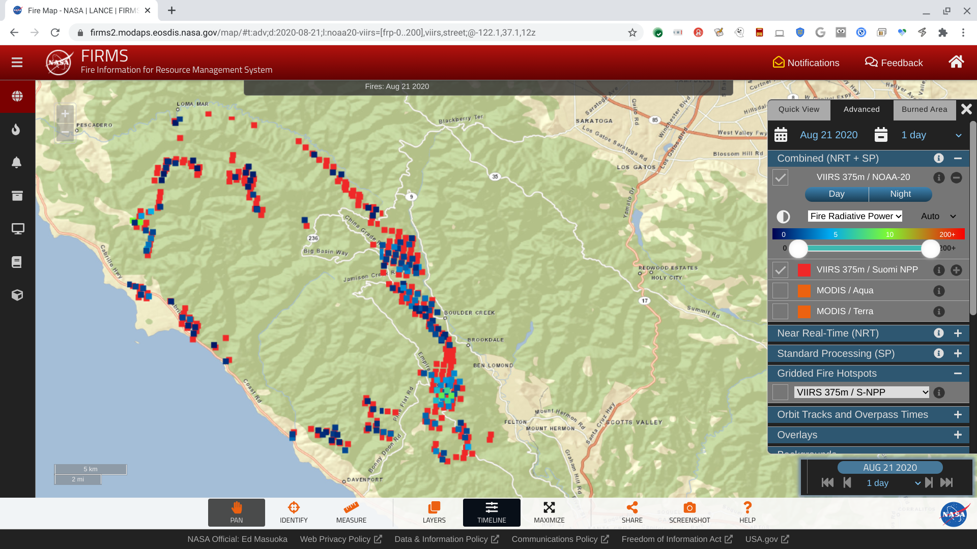
As dozens of fires continue to blaze across Northern California, I’m grateful for helpful maps and materials posted to Twitter and 95033talk to give insight into where the flames are heading. But I wanted more detailed maps, so I’m sharing this map series of the CZU Lightning Complex Fires generated using NASA FIRMS, which is operated by the NASA/Goddard Space Flight Center Earth Science Data and Information System (ESDIS) project.
The FIRMS Fire Maps allows you to interactively browse the full archive of global active fire detections from MODIS and VIIRS satellite systems. Near real-time fire data are available within approximately three hours of satellite overpass with imagery in 4–5 hours.
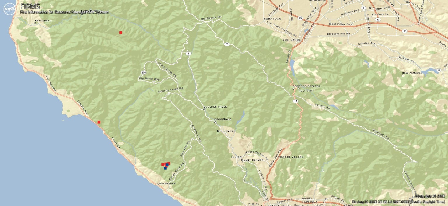
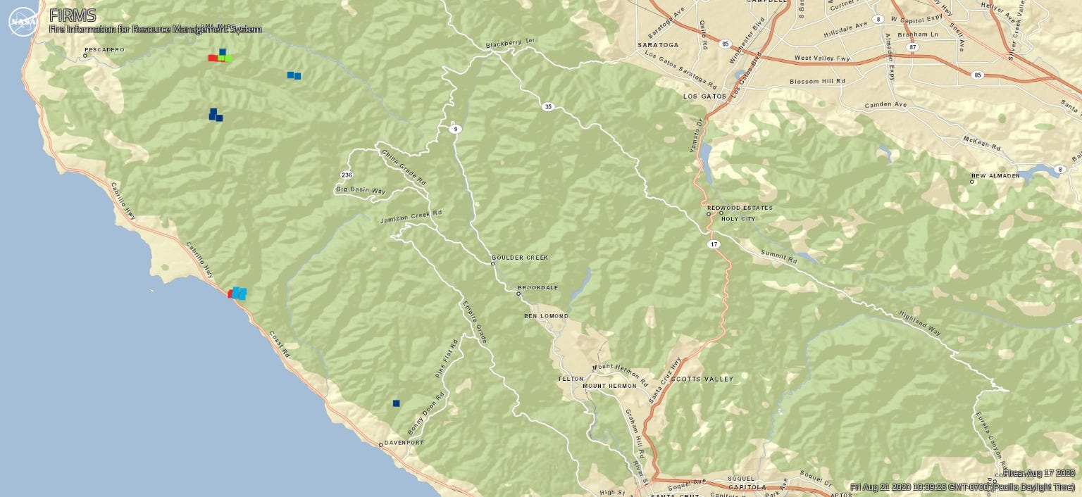
The maps suggest notable cooling since 19 August. See this post for estimates of the area and power of these fires based on NASA FIRMS satellite data.
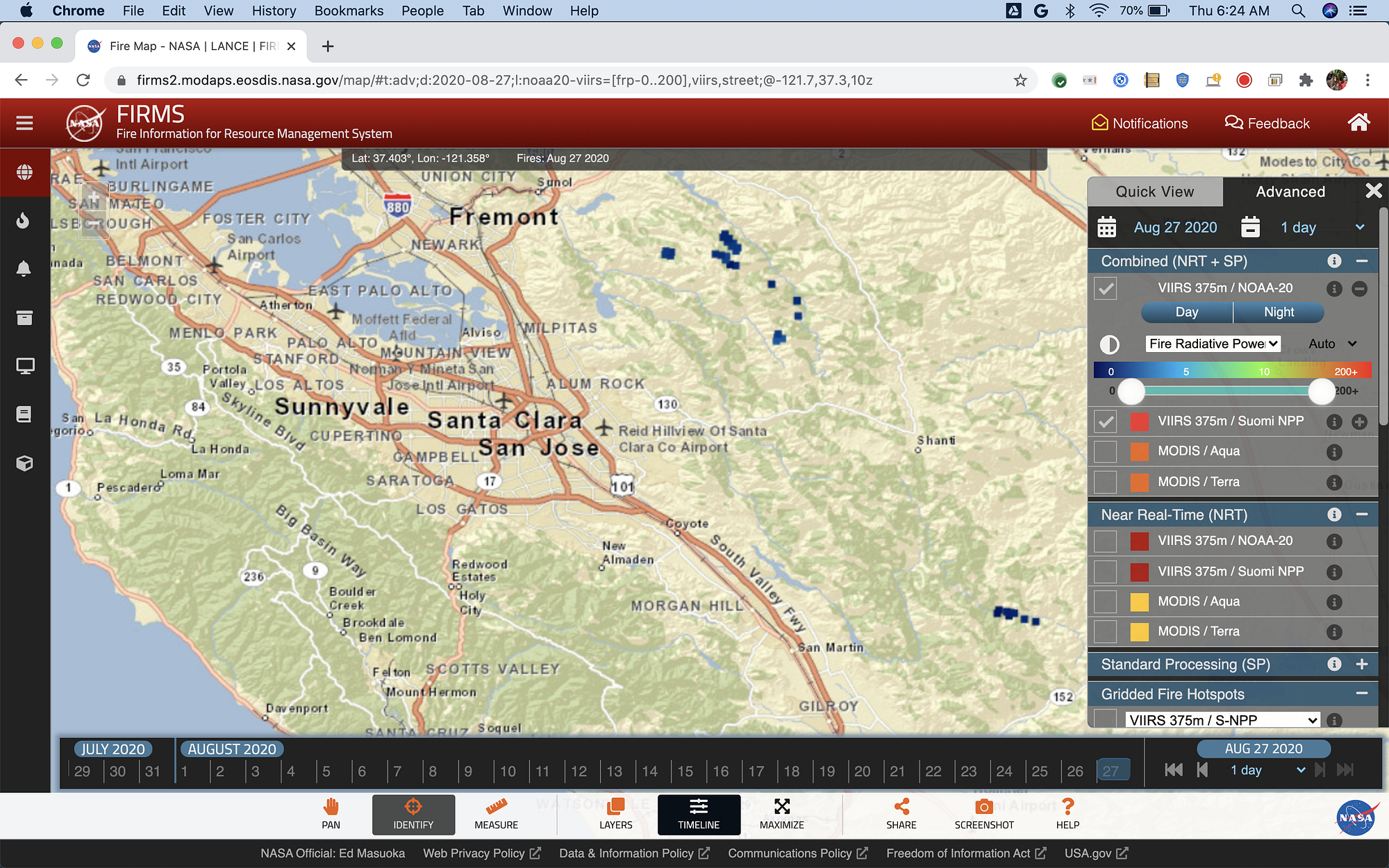
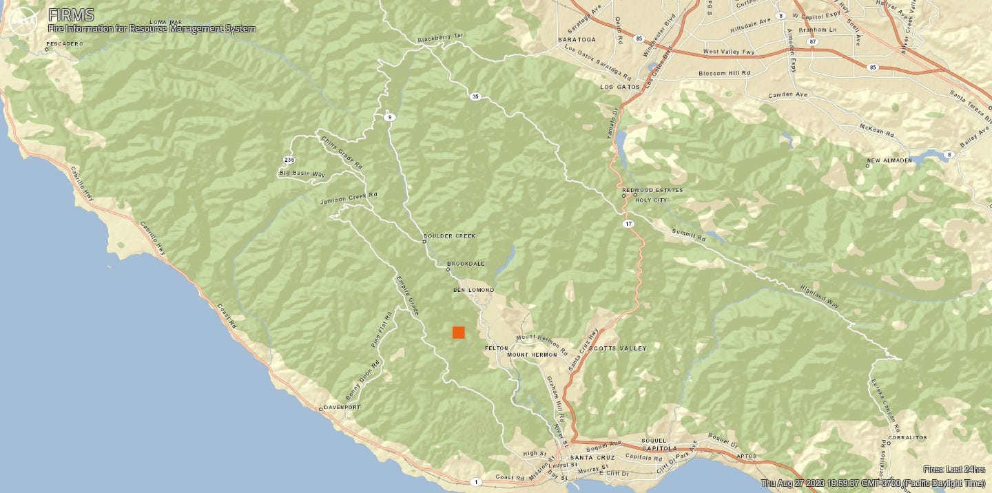
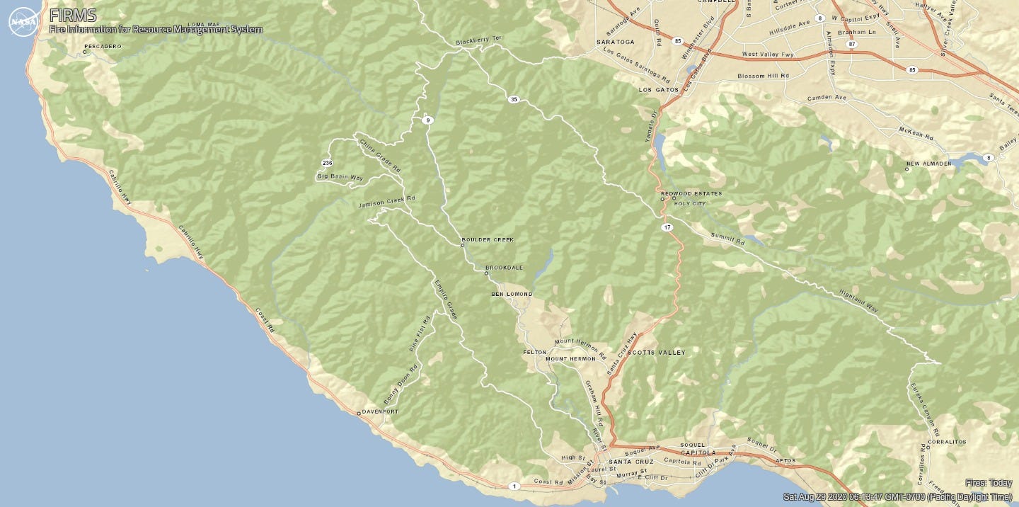
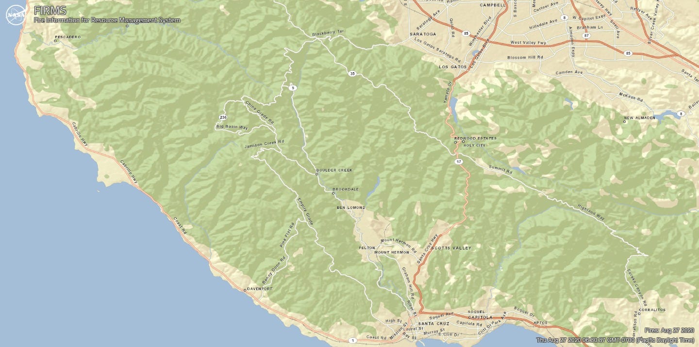
Satellite maps for August 27 show no fire detected in the CZU Lightning Complex, although they do show detections for the SCU Complex, confirming the passage of the satellites. I assume this is a combination of the marine layer and Cal Fire’s good work.
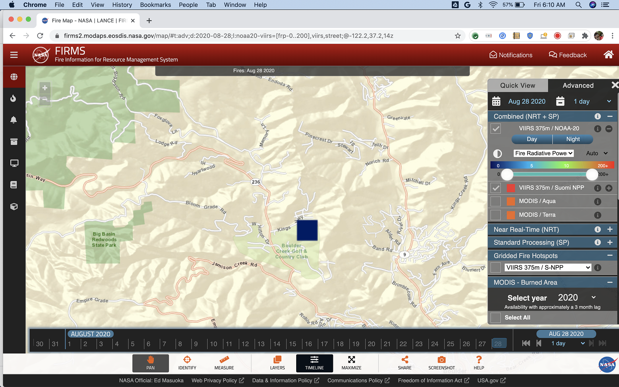
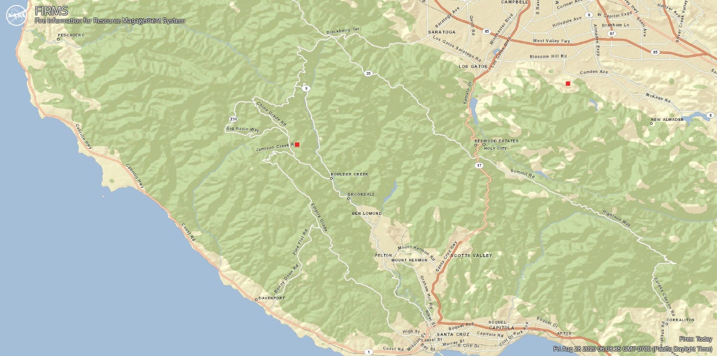
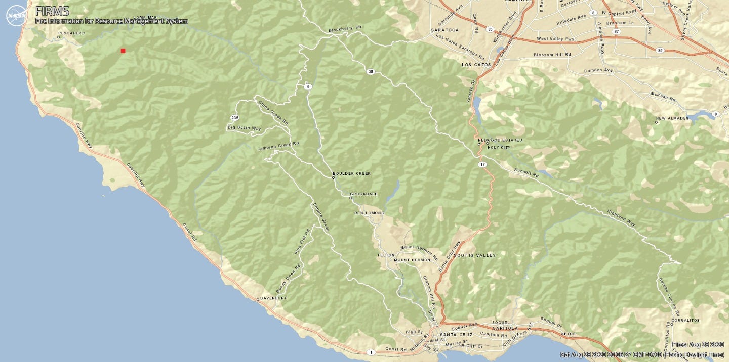
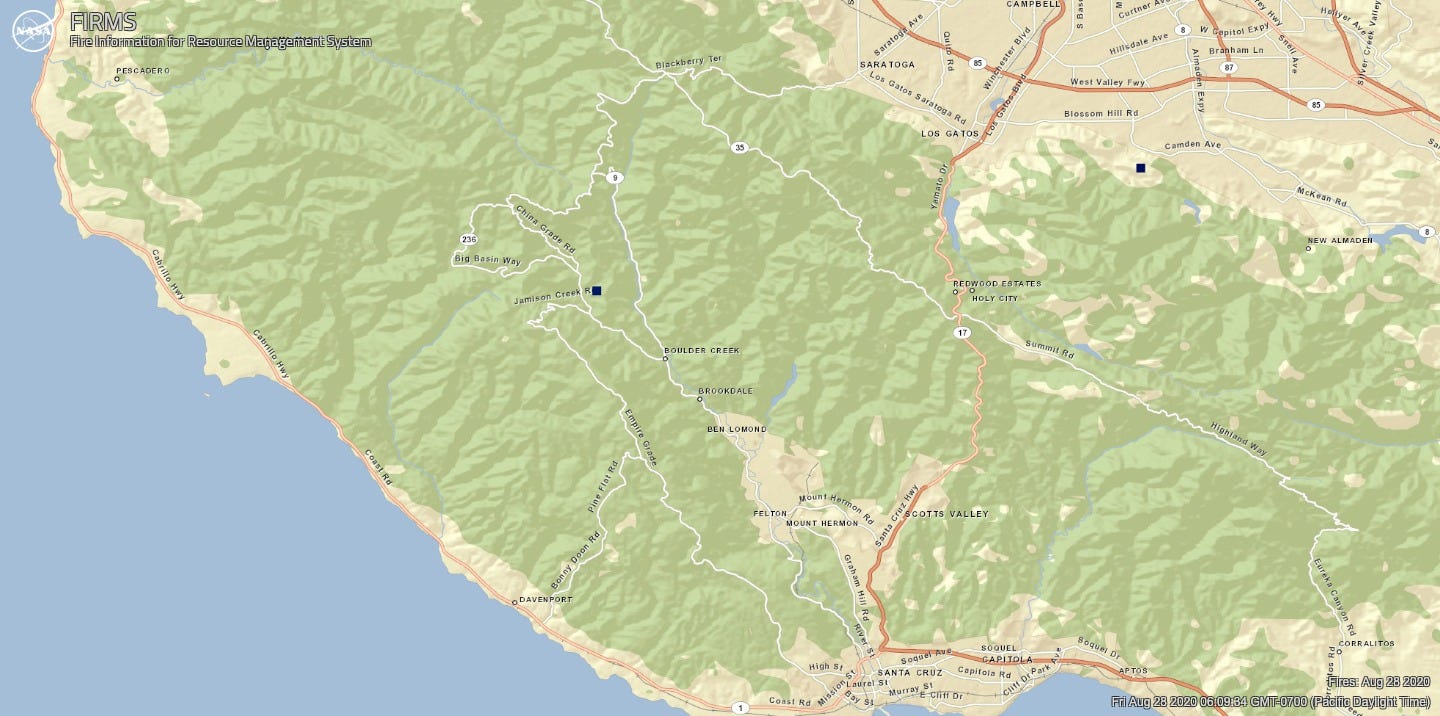
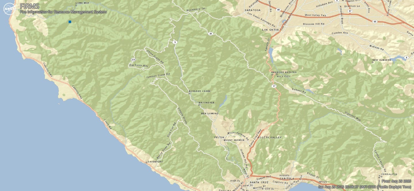
On August 28, satellites captured one hot spot near the Boulder Creek Golf & Country Club, at 3 AM Pacific.
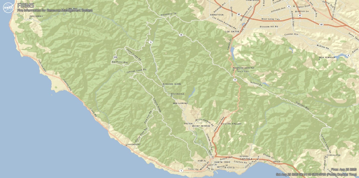
On the morning of August 29 there were no hotspots. Of course this doesn’t mean the fire is out, however, as this cool video from CALFIRECZU shows:
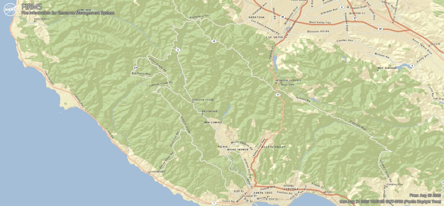
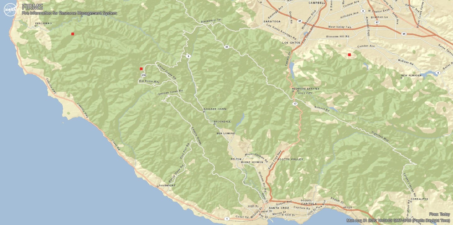
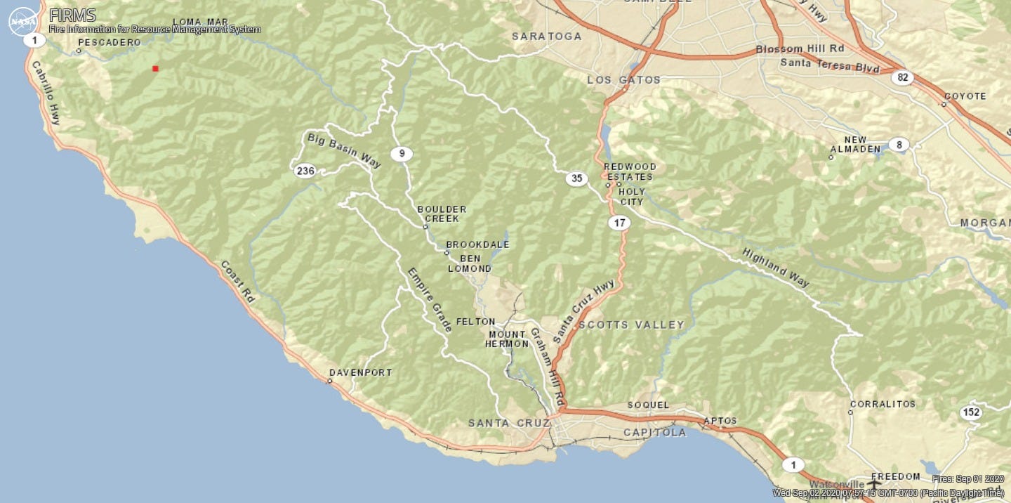
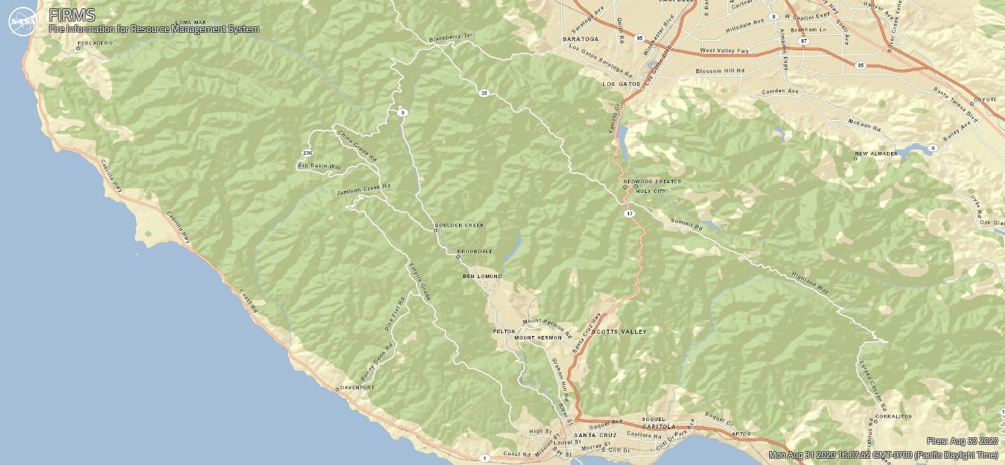
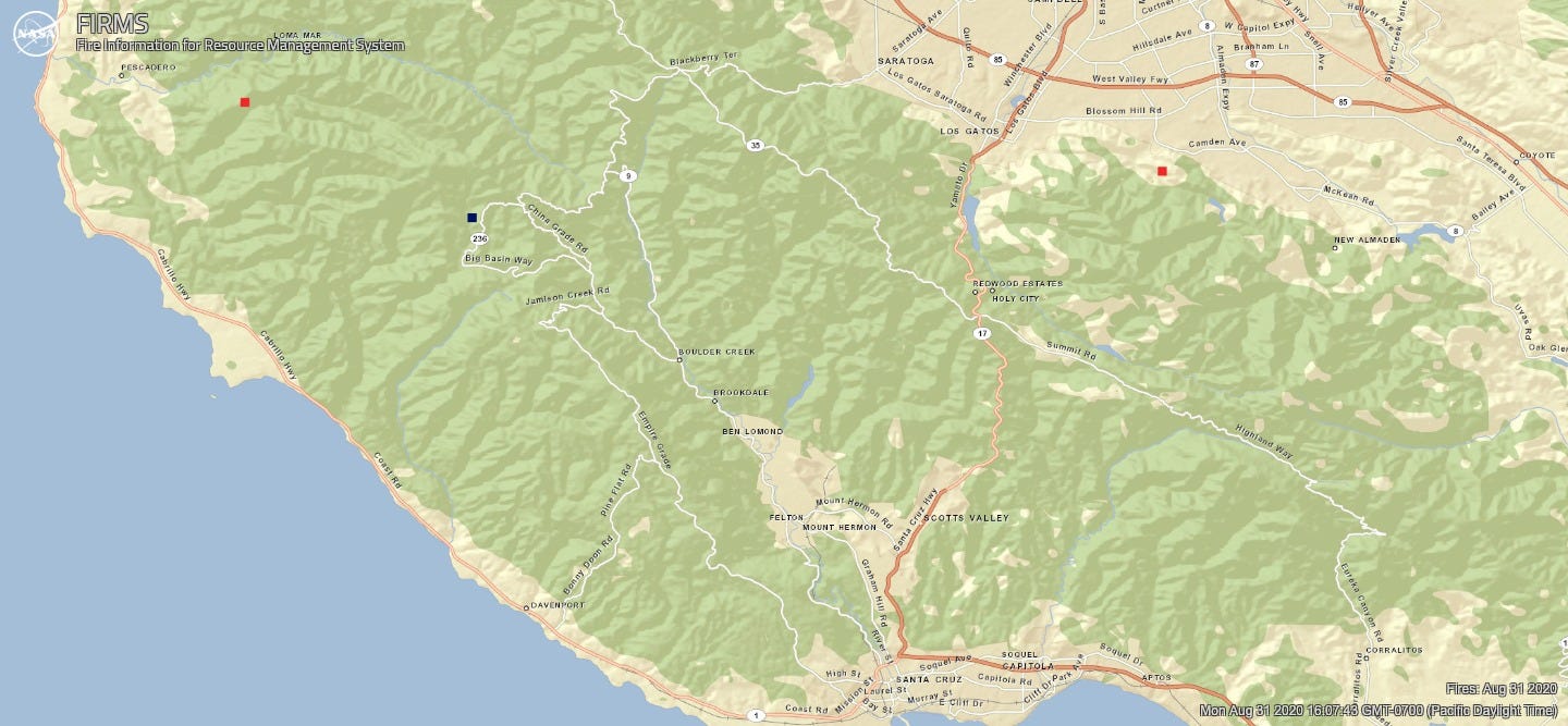
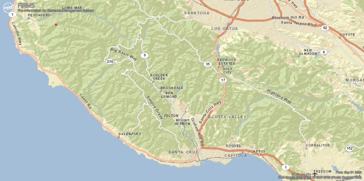
On August 30, satellite captures at 2:24 AM, 3:12 AM and 4:00 AM Pacific did not detect fire in the CZU Complex. On August 31 they detected two hotspots, one north of Butano State Park at 2:54 AM and another at 3:42 AM between N. Escape Road and Big Basin Way. No hotspots were detected the morning of September 1, with satellite captures at 2:36 AM and 3:24 AM. One hotspot north of Butano was captured at 1:54 PM Pacific.
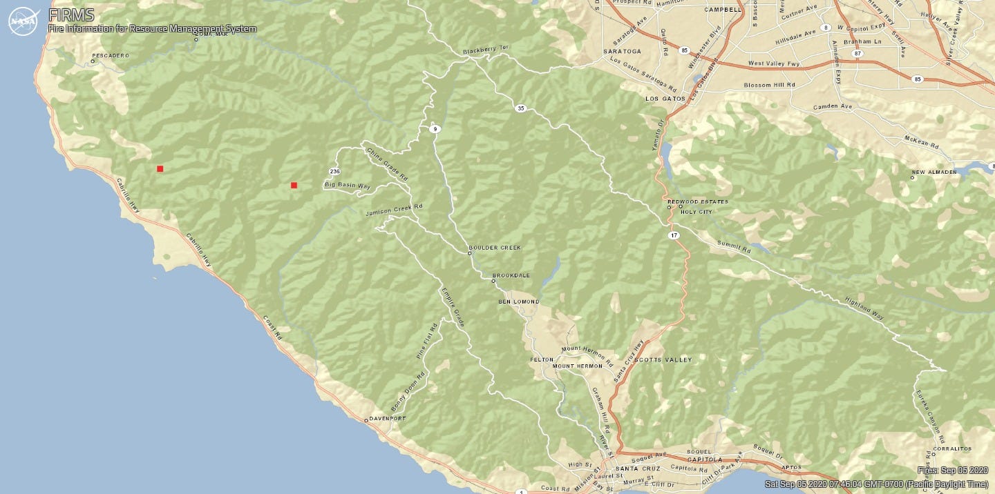
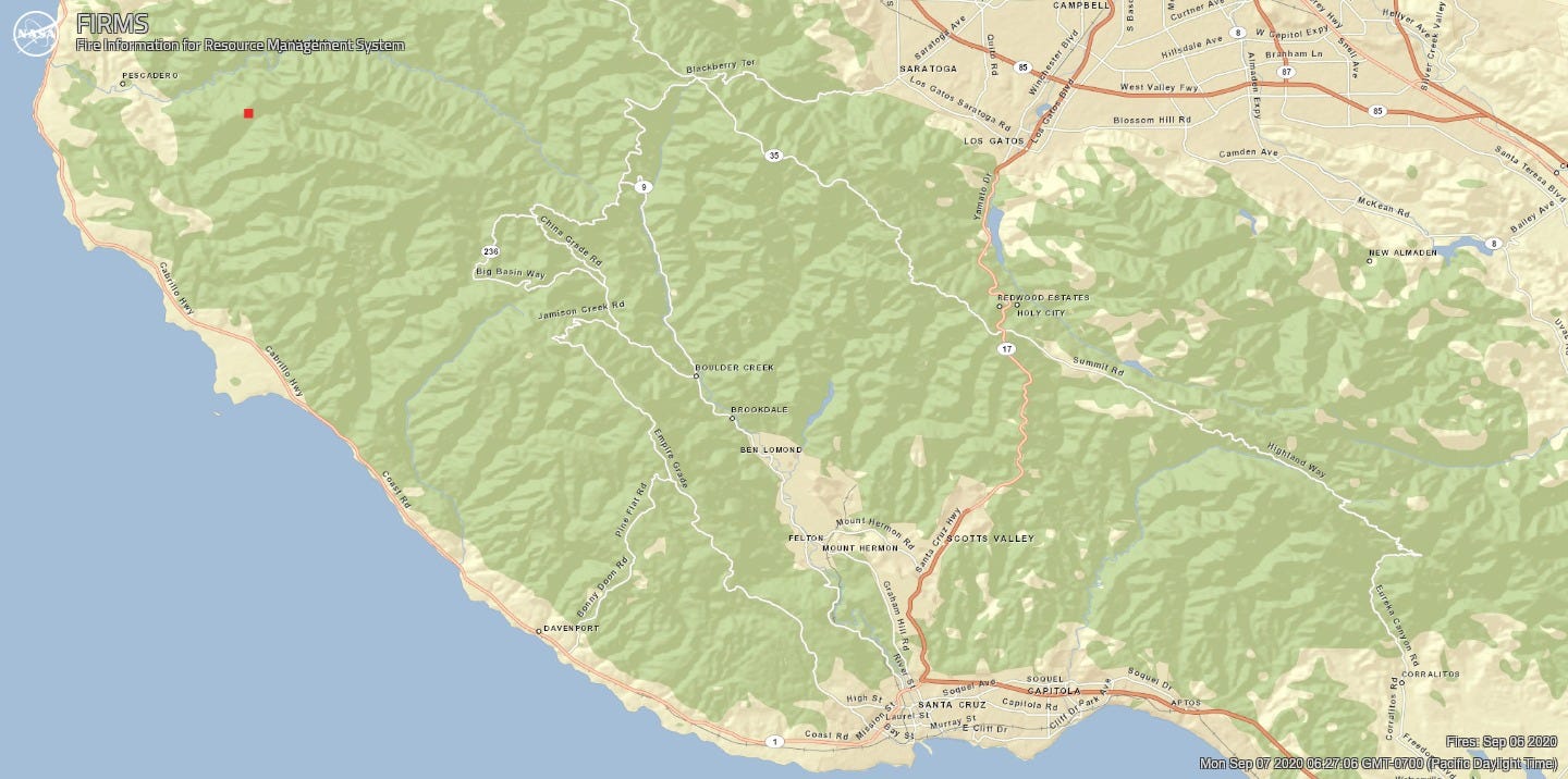
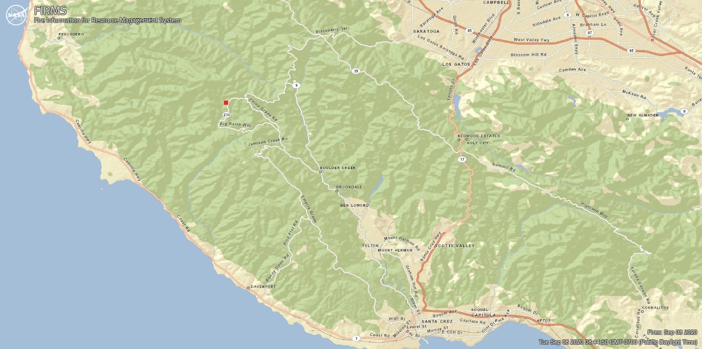
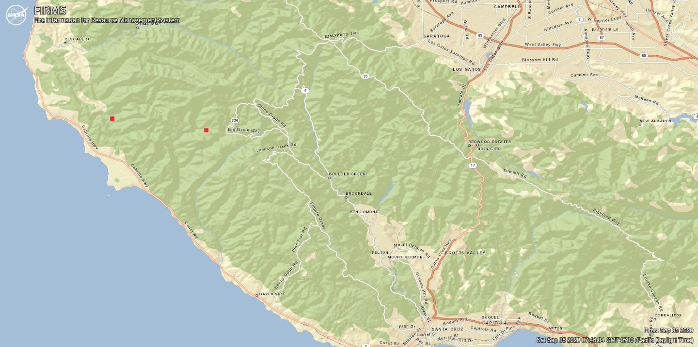
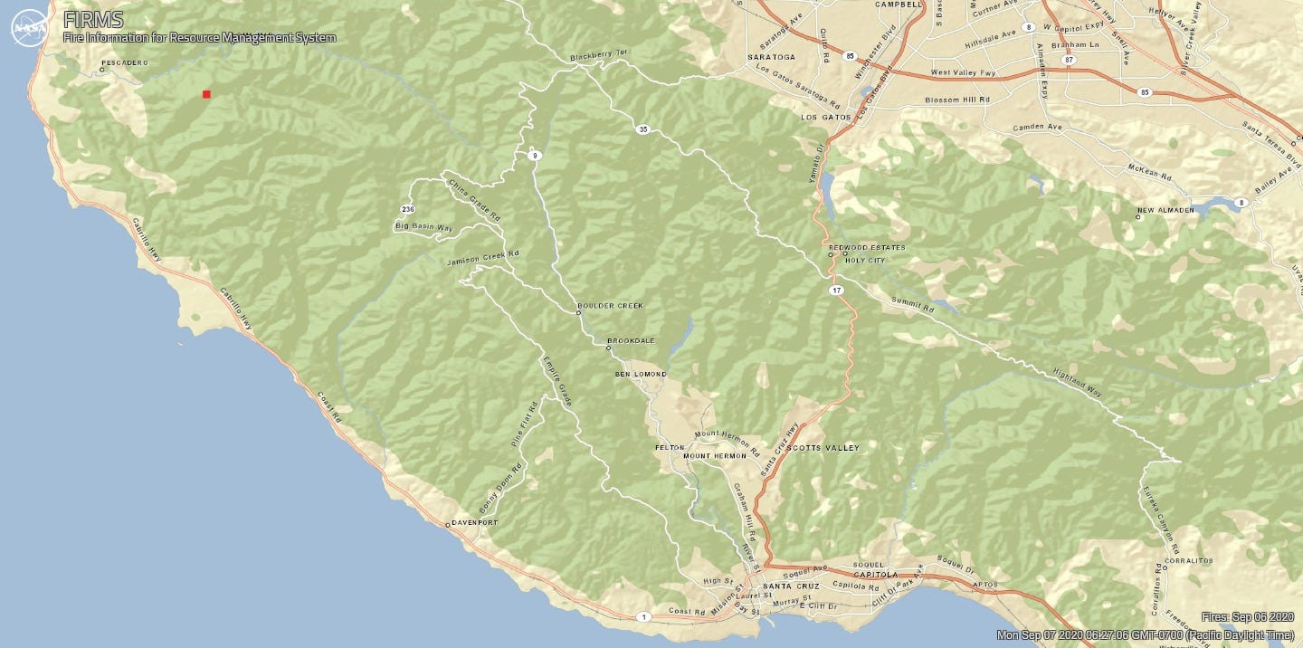
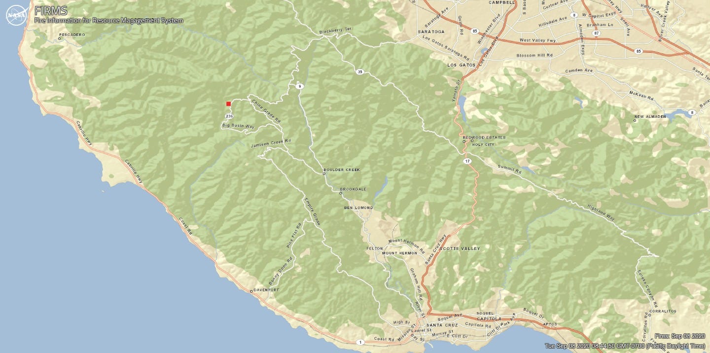
On September 2 it appears that no hotspots were captured in either the CZU or the SCU incidents, with satellites capturing a hotspot east of Livermore at 3:06 AM. Similarly the satellites passed with no hotspots detected on September 3 or September 4. On September 5, the impact of warmer weather was visible with two hotspots, one in Big Basin and one near Gazos Creek Rd, captured at 3 AM Pacific. They did not appear on daytime satellite captures. Satellites did capture one hotspot at 2 PM on September 6, north of Butano State Park. There were no detections on September 7, but on September 8 there was a hotspot between 236 and N. Escape Road, captured at 2:54 AM Pacific.
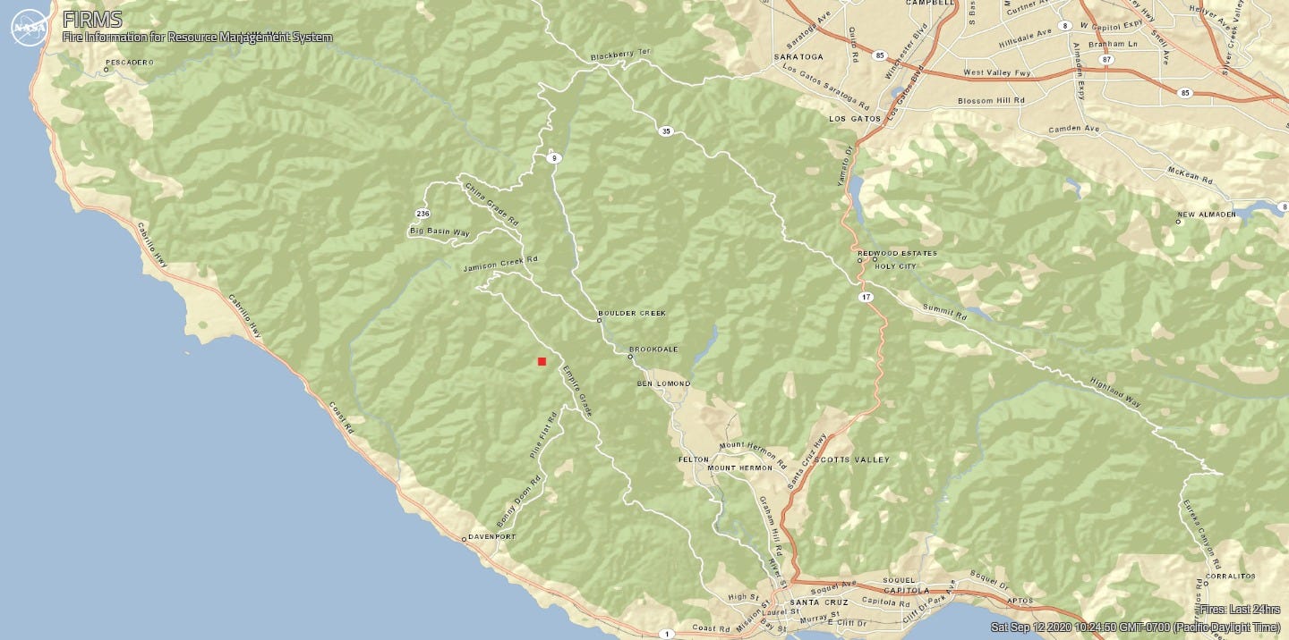
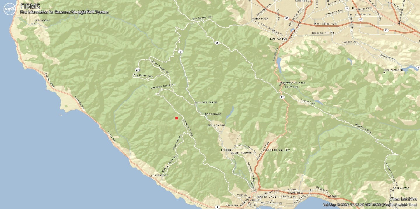
No hotspots were captured on 9, 10 or 11 September, but on 12 September the VIIRS system captured a hotspot at 3:18AM Pacific near the intersection of Empire Grade and Alba Road.
Thank you, firefighters, and everybody who finds a way to help our community through this disaster.
Sign up for The Bold Italic newsletter to get the best of the Bay Area in your inbox every week.
Series 1. CZU Lightning Complex, Near Real-Time view with default settings
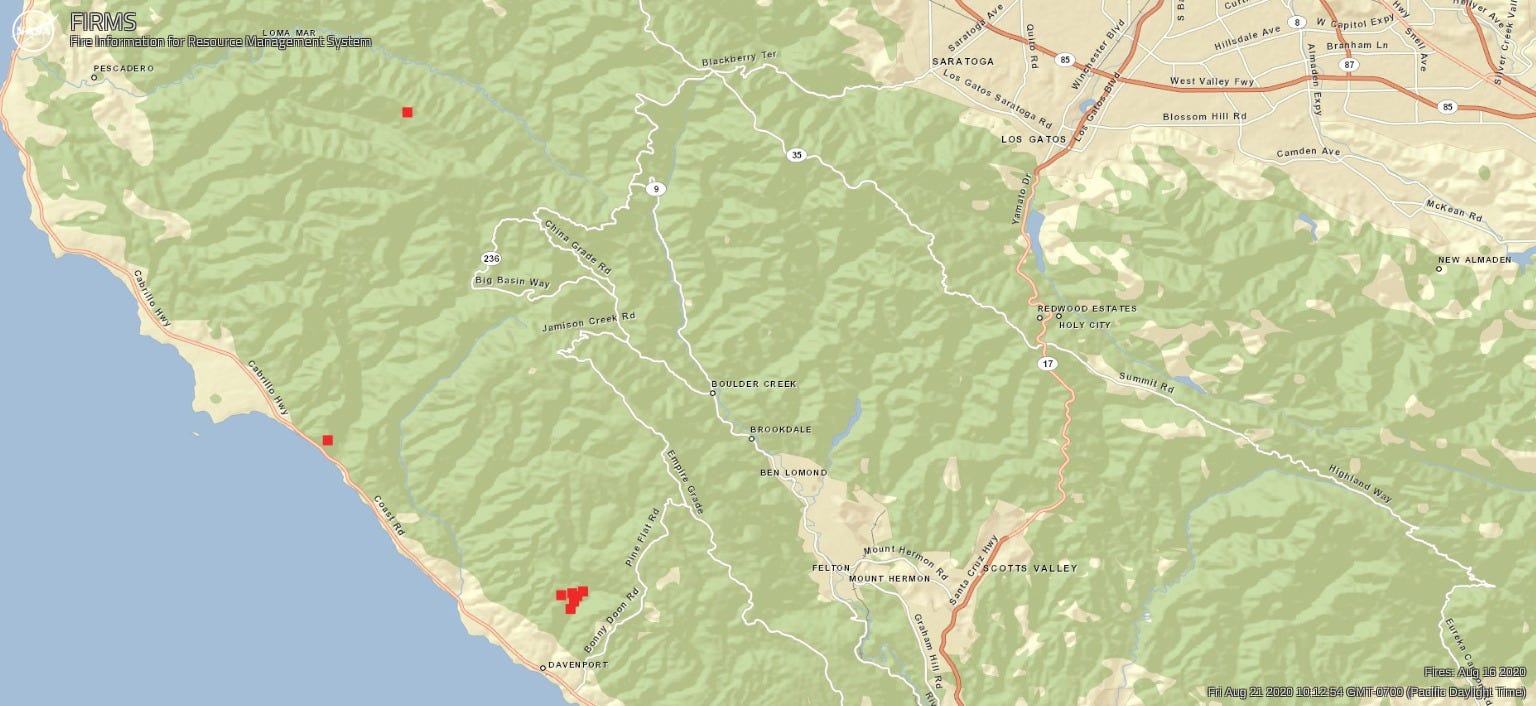
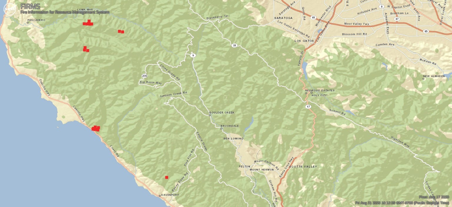
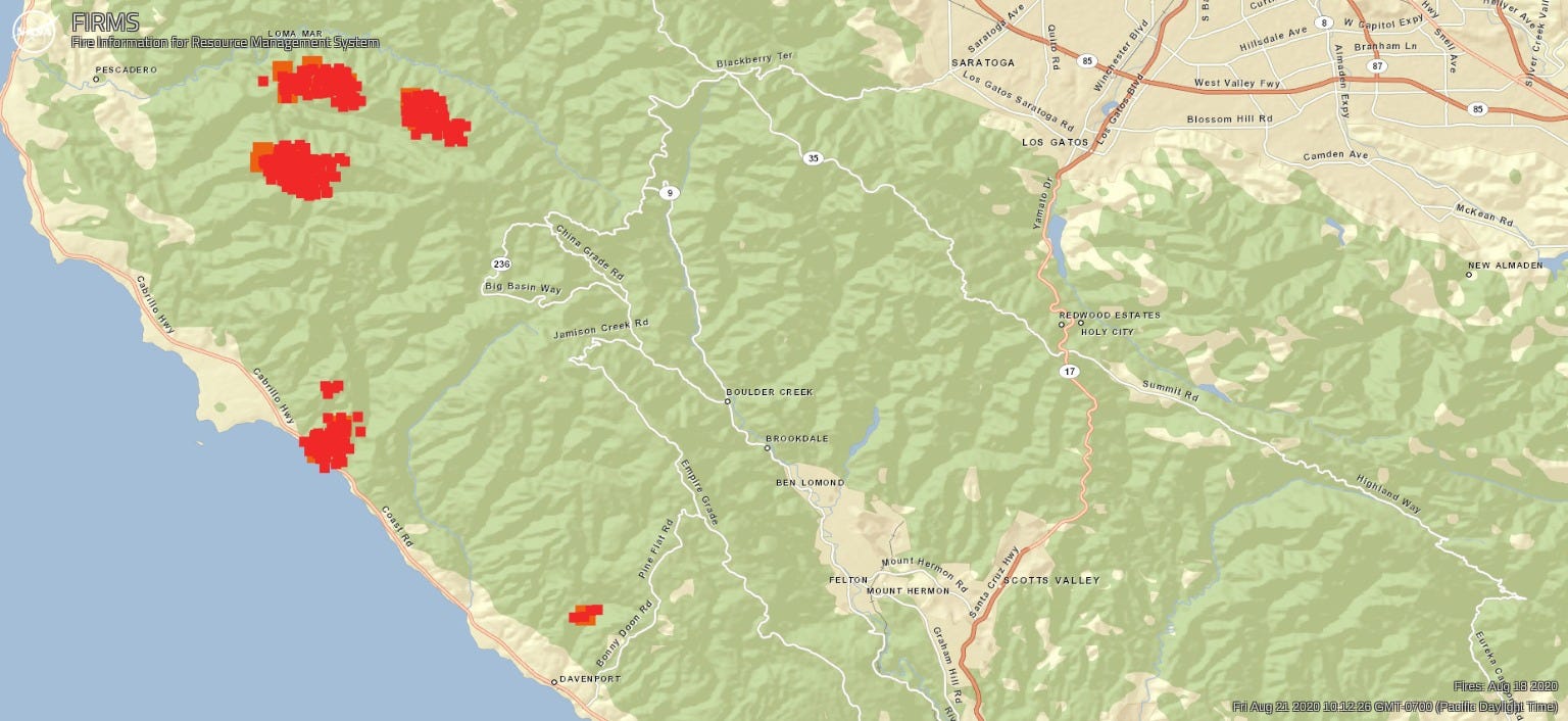
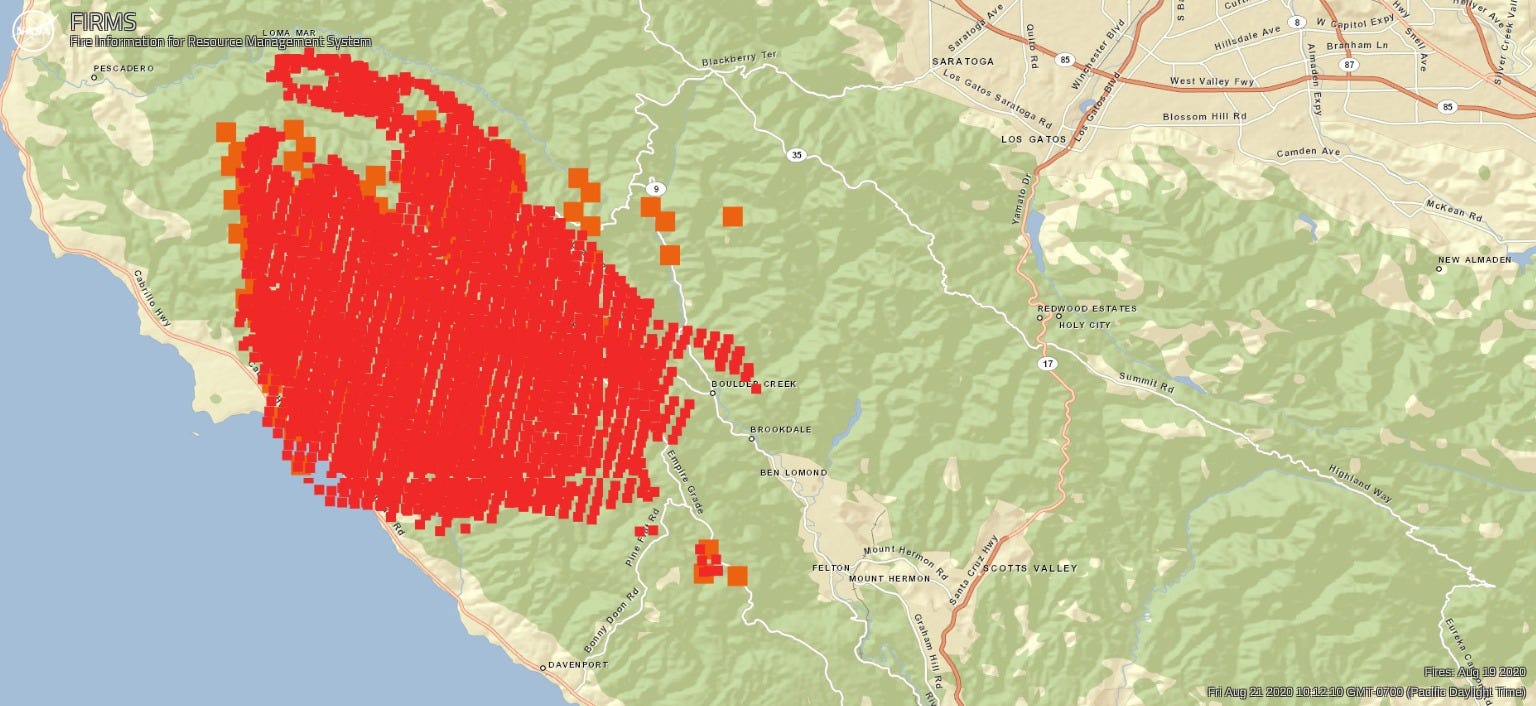
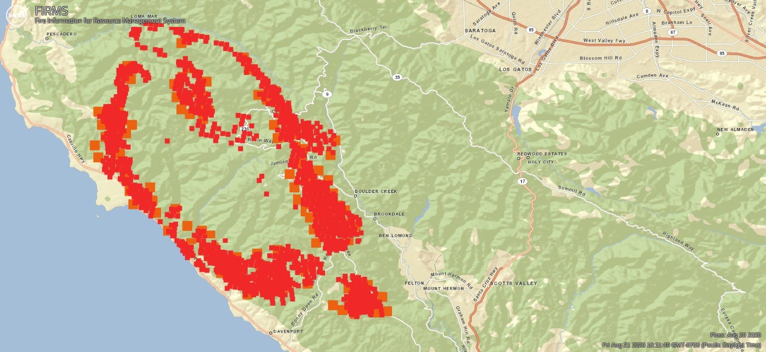
Series 2: CZU Lightning Complex, Near Real-Time view settings to show Fire Radiative Power
Other useful links:
- Official CAL FIRE updates with information on status, evacuation warnings and orders, and evacuation centers
- National Fire Situation Awareness map. Incorporates both satellite detection and other reporting sources.
- Evacuation map with address lookup
- Webcams
- Air quality reports from AirNow.gov and PurpleAir.com
- Wind information
- Live lightning strike tracker
- Flight Radar Maps
- Latest fire perimeter on Google Maps (probably uses NASA FIRMS data)
- NASA FIRMS data downloads
- ICS Standard symbols for mapping wildfires


